
Let me just say from the get-go that if you ever have the choice of visiting Akureyri, do so! Akureryri is located in the north of Iceland, just south of the Arctic Circle. After having done both the South Shore (on a previous visit) and the Golden Circle tours from Reykjavik I would say that the scenery and sites in the north are so much more spectacular. I fell in love with Iceland all over again after touring the area with Ana from Nonni Travel. Surprisingly, approximately 90 ships per year visit Akureryi so the like their neighbors to the south in Reykjavik, are very well set up for the tourist trade. Though Akureryri is the second largest city in Iceland, there are only 18,000 that live here year-round. Given its location, there are times during the summer when the sun never sets. Of course, during the winter, there are times when there are only a few hours of daylight. I assumed that there would be no daylight hours at all, but apparently, that is not true.
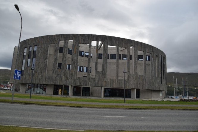
To reach Akureyri from the sea, you travel down the longest fjord in Iceland (60 km in length). If you are lucky, you may see whales as your ship navigates the fjord. If you are here early enough in the season (before August), there may be puffins about as well. The town itself is fairly small and walkable. We drove along the waterfront on the way to our main destination, Lake Mývatn. We passed by the Hof, cultural center of the town.
Our first brief stop was at an overlook of the town. We snapped a few pictures and moved on. The scenery was much the same as that we had seen around Reykjavik. There were plenty of sheep about; they have about two more weeks of freedom before they will be rounded up, sorted, and returned to their owners. This is a large social occasion here.
There were some horses and herds of cows as well. The cows and sheep are brought in for the winter but the horses are out in the wild year-round. I guess they have to be pretty hardy! There seemed to be a few more trees here than to the south. Trees grow slowly here due to the lack of sunlight. Most of the conifers looked to have been planted in recent years; there were no old-growth stands of trees.


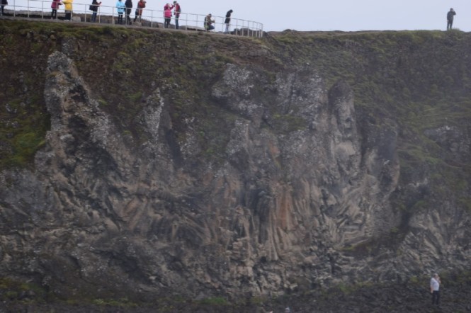
As we drove, Ana told us of the Icelandic leader that decided in the year 1000 that his country would turn away from the old Gods (Odin, Thor, etc.) and fully embrace Christianity. To mark the occasion, he threw the old pagan idols into the waterfall that became known as Goðafoss (waterfall of the gods). A church was built in the year 2000 to commemorate one-thousand years of Christianity. The altar piece is a large picture window showing the beauty of nature as opposed to the typical artwork seen in most churches.


I thought that you could almost imagine the faces of the old gods in the cliffside near the waterfall.


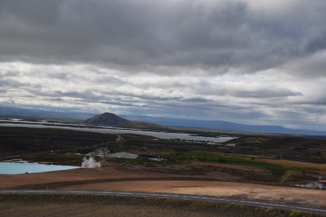
Much of the rest of the sites we visited were situated in the vicinity of Lake Mývatn, a very large and fairly shallow lake surrounded by many islands that were formed from volcanic eruptions. Arctic char and trout are the most common fish here and many birds can be found here as well. But, the main draw to the area are the geothermal activity and volcanic formations. There are pseudo-craters that were formed by steam explosions from volcanic eruptions. The local people will tell you that the many lava pillars that surround the lake are actually trolls that are guarding it.
There is a local bakery here that uses the geothermal heat to bake rye bread. The loaves are baked for 18 hours at 100°C. The sandwiches at the nature baths that we were headed to are made from this delicious Icelandic treat.
The highlight of the day was a stop at the Mývatn Nature Baths. This is similar to the Blue Lagoon outside of Reykjavik but much less touristy. Before entering the baths you are instructed to take a full shower before donning your swim suit and heading out to the pools. The water is the same lovely blue color as the water in the Blue Lagoon. We spent about an hour soaking in the warm mineral water and enjoying the beautiful surroundings before grabbing a quick bite to eat at the café and heading out to the geothermal area of Hverir.


Iceland is growing by an average of 2 cm per year due to volcanic activity. You can see where a major split has taken place:


Hverir is a much larger and more impressive area than Geysir (Golden Circle Tour). The paths to the mud pools and sulfur pits were very muddy and slippery. We all ended up tracking lots of mud back into the van! Though there was no geyser here, there was a steaming pillar of rock that hissed and spewed hot steam. A few brilliant tourists decided to touch it to see if it was hot…


We took another quick photo stop to capture pictures of Lake Mývatn and the mineral baths we had bathed in earlier. Given the steam the escapes from the ground everywhere, local people joke that the potatoes here come boiled out of the ground!
We passed by a large crater, Viti, devoid of all vegetation on the way to Dimmuborgir, “The Castle of the Trolls”. Legend has it that the trolls were having such a great time partying during the night that they lost track of time and the sun came up. Sun shining on trolls turn them to stone. If you look carefully at the pictures below you can see the trolls in dancing and drinking positions, as well as their castle.


We loaded the car one final time before stopping at Skútustaðagígar to walk around one of the pseudo-craters. If we had more time we could have walked around many of the pseudo-craters; there are walking paths all around the area.


We had such a wonderful day; the time really flew by. On the drive back Ana told us about some of the movies that have been filmed in the area. Some of the scenes from Game of Thrones were filmed here, too.
Before we knew it, we were back to Akureyri. Did you know that the red lights here are heart shaped? A few in our group wanted to walk around town and so were dropped off there; the rest of us were dropped off in front of the ship.


We will be at sea tomorrow and then headed to the Orkney Islands in northern Scotland.
