I had been feeling so sorry for myself for losing the pictures I took in the Shetland Islands and around Reykjavik, but then we went to northern Iceland and the Orkney Islands and saw similar but more spectacular sites! We were very happy to get off the ship; we had a very rough day at sea yesterday.
The process of booking a tour in the Orkney Islands is a little different than most ports. www.orkney-tour-options.com is a clearinghouse that contacts guides that work in the area. The guides are provided with your contact information and those that are available then contact you directly. From there you choose a guide and book them. I chose Sue Casely (guide) and her husband Chris (driver). I found two other couples on Cruise Critic that joined us for the tour.
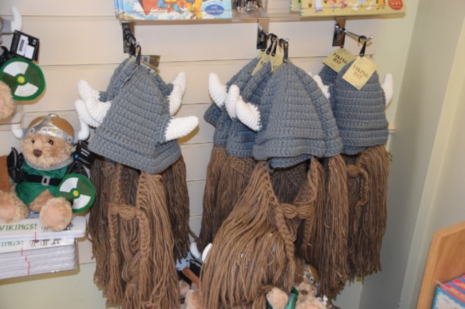
There was a small gift shop located outside the gate. Since we left the ship a little early we walked through the shop. A woman was spinning wool and a couple of others were knitting. You can’t say that the goods here are not local!


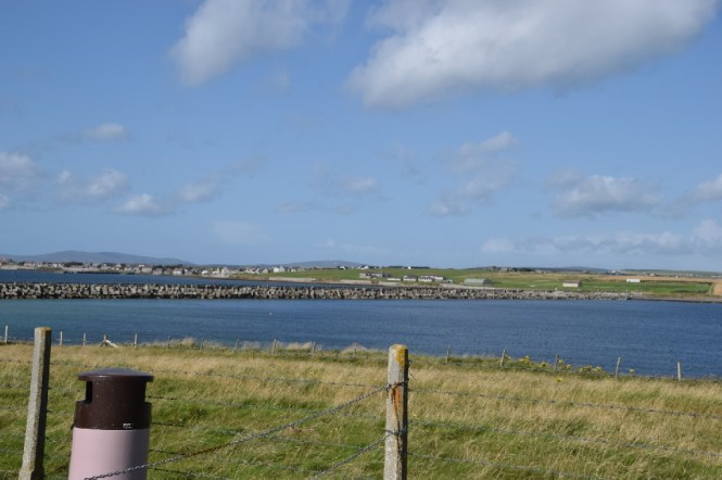
Sue and her husband met us promptly at the appointed time for our four-hour tour. The Orkney Islands are located south of the Shetland Islands. Whereas most Shetland islanders are fishermen that have farms, Orkadians are farmers that fish! Just like in the Shetland Islands, the main island is known as the mainland. There are 70 islands here; 20 are inhabited. Kirkwall (where we docked) is the largest city (population 9,000). Fishing is the main industry; tourism is #2. There also seem to be quite a few distilleries given the small size of the island! We drove through town (blink and you will miss it) passing by St. Magnus Cathedral (built in 1137) and Earl’s Palace (late 16th century). Patrick Stewart built the palace. We had learned about him in the Shetland Islands – the locals here hated him as much as the locals there. There is a small airport here that becomes an international airport only during the summer when flights to Bergen take place. The rest of the year the flights are domestic only. To the north, there is a flight that will take you from Westray Island to Papa Westray Island. This one takes a whole 2 minutes to complete! It is listed in the Guinness Book of World Records as the world’s shortest flight. If you take the flight you are given a certificate to commemorate the occasion!
After leaving town we drove through bucolic fields with many herds of sheep and cattle. We saw Skapa Flow, a 150 square mile harbor that was very important during the world wars. It was used by the Vikings. Just like in the Shetland Islands, the language here is Scottish mixed with Norse due to the Viking invasions.


The Orkney Islands were an important British naval base during both world wars. During WWI, ships were sunk in Skapa Flow to be used as block ships. By WWII, these ships had shifted, allowing German U-Boat 47 to enter through the gaps and sink HMS Royal Oak. This event is marked yearly by a solemn ceremony put on by the Royal Navy. After the sinking of the Royal Oak, Winston Churchill realized that the harbor needed to be reinforced, and so barriers were constructed.
During WWII, the British captured Italian soldiers in North Africa and brought them to the Orkney Islands to POW camps. These prisoners built the barriers. In exchange, the Italians were given a couple of quonset huts to create a place of worship. This is now known as the Italian chapel. The Italians were given nothing more than the huts so had to scavenge for décor. We stopped to visit the site and it is quite amazing what they were able to do with the humble huts!


Another interesting fact regarding the military history here is that in 1919 the German fleet was trapped in Skapa Flow. The chancellor chose to scuttle the ships rather than surrender. In the 1920’s the U.K. salvaged the ships which helped create the navy that was able to fight the Germans again in the next war. Of the approximately 54 ships that were scuttled, only 7 remain.


On our drive to our next stop, we were delighted to meet a couple of very unique local inhabitants, Peter and Brian. They are Mangalitsa Hairy Pigs from Hungary! Who knew such a thing exists? Apparently they are mighty fine eating and so are prized animals. At one point they were near extinction; only 198 were left but the population has rebounded and they are now being raised for gourmet dining. Friendly pig. One could even say they were a couple of hams!


We also passed by a herd of Highland Cattle – even the females have horns! And, we saw a few Shetland ponies! I was so disappointed that I lost my pictures of the ponies I took while in the Shetlands so was quite delighted to see some here.


By the shores of Loch Stenness we visited Unsten Tomb. The Neolithic people that lived here 5.5 to 6 thousand years ago used tombs such as this but did not bury bodies in them; they put a few select bones from the dead in them, but not the entire complement of 206. In order to get into the tomb you had to hunch over and go through a narrow passageway. The tomb itself has several chambers and is open at the top so daylight comes in.


Next up were two sets of standing stones: the Standing Stones of Stenness (thought to be the oldest in the U.K.) and the Ring of Brodgar (3rd largest in the U.K.). There was some graffiti from the late 1800’s carved into one of the stones. Right next to it was some graffiti from Viking times. Using runes, the defacer wrote “Bjorn was here”. In between the two sets of stones we passed by a building with an Orkney sand stone roof. Sue provided us with a yummy treat – shortbread from a local bakery. No wheat is grown on the island so the shortbread was made from bere (pronounced bare) barley.


The most famous site on the tour was Skara Brae which is a Neolithic village that was unearthed in 1850. It is unique in the that the 10 houses that were uncovered were all joined to a communal passageway; the only such place that has been found in northern Europe.
There was a reconstructed home in the visitor center; fortunately it had a “modern” entryway that was full height. The actual homes had entries that a person would need to stoop to get into (maybe 4 feet high?). The center of the home contained a fire pit. There were rectangular stone cubicles that are thought to be beds (though they were awfully short – they looked like troughs). On average, the men were about 5’7″ and the women 5’1″. In the floor were a few pits that were thought to be used for water storage or possibly cooking. The inhabitants had a very good diet: fish, beef, lamb, goats, pigs and shellfish were all food sources. Since they grew yeast and barley it is thought that they also could bake bread and make beer. They also probably made cheese from the animals’ milk. They did not weave so probably used animal skins for clothing.


Eventually the sea encroached on the village and it was partially washed away. It was filled with sand until it was discovered in the 1850’s.
On the walk from the visitor center to the historical site, markers in the ground mark historical events proportional in time and distance from Skara Brae. The first marker was the moon landing in 1969. Down the path were other markers, such as the first crusade (1095 AD) and the fall of Rome (476 AD). Getting closer to the site we passed markers for the Temple of Solomon being built (962 BC), Stonehenge (2100 BC) and Pyramids of Giza (2500 BC). Immediately following the marker for the Pyramids of Giza, you enter the grounds for the ancient city.


On the beach below, creative souls have built miniature Stonehenge as well as other monuments.


The time on our tour had flown by; it was already time to return to the ship. We drove back through more fields and Sue told us miscellaneous facts about the Orkney Islands. We had the option of being dropped off in town but all on the tour preferred being dropped off at the ship instead. FYI for future cruise passengers: if you don’t take a tour, there is a free shuttle from the dock to town.